
We have developed an algorithm for retrieving the cloud properties from thermal infrared measurements by the Japanese new-generation geostationary satellite, Himawari-8 (Iwabuchi et al., 2018). The Himawari-8 has significantly improved observation capabilities with 16 bands in visible-to-infrared spectrum and high temporal and spatial resolutions.
With the help of high frequency of observations (10-minunte interval), we investigates tropical cloud evolution through separation of different cloud types and reveals typical features of diurnal cycles related to the topography in the vicinity of the New Guinea (Fig. 1). Over land, middle clouds increase from 0900 to 1200 local solar time (LST), deep convective clouds develop rapidly during 1200–1700 LST with a subsequent increase in cirrus and cirrostratus cloud amounts. The present study demonstrates the utility of frequent observations by Himawari-8 for life cycle study of cloud systems, owing to the ability to capture their continuous temporal variations.
(a)
 |
(b)
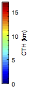 |
Figure 1. Time series of (a) cloud optical thickness (COT) and (b) cloud top height (CTH) estimated by integrated cloud analysis system (ICAS) for the New Guinea region. Results are shown for a period of January 14–19, 2016.
Publication
Iwabuchi, H., N. S. Putri, M. Saito, Y. Tokoro, M. Sekiguchi, P. Yang, and B. A. Baum, 2018: Cloud property retrieval from multiband infrared measurements by Himawari-8. J. Meteor. Soc. Japan, 96B, 27-42, 2018. https://doi.org/10.2151/jmsj.2018-001